Our Favorite Waterfall Hikes Around Buffalo River Country
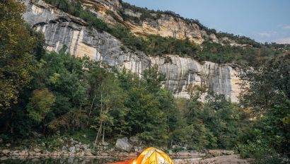
April 2, 2025In Buffalo River Country, the power of the elements is on full display in the Spring. During the Arkansas rainy season (March through May), the area receives around five inches of precipitation per month. This seasonal rainfall turns the rugged terrain into a waterfall hunter’s dream, with hundreds of mesmerizing cascades flowing from the heart of the Buffalo National River to the surrounding Ozark National Forest. With so many to choose from, getting started may be daunting, so we’ve compiled a list of our favorite waterfall hikes in the area.
Begin your waterfall hunt with a stop at the Buffalo Outdoor Center store in Ponca for maps, trail conditions, and local tips to make the most of your adventure.
Lost Valley
Distance: 2.2 miles roundtrip
Difficulty: Easy
What we love about it: With good reason, this is the most popular hiking trail in the national park, as well as the state of Arkansas (and it’s only 1.5 miles from the Buffalo Outdoor Center). This trail features multiple waterfalls, towering bluffs, house-sized boulders, and caves.
Locals’ tip: Bring a flashlight, and watch for bats when entering Eden Falls cave. As you enter, stay to the right (the left requires you to crawl but winds up at the same place) and follow the narrow corridor back to the waterfall room. Taller folks will need to stoop here and there in the passage. Once you’re in the waterfall room, it’s fun to turn the flashlight off for a few seconds and give everyone a chance to appreciate just how dark a cave can be! (Make sure you have a good grip on the flashlight when you do, and keep your finger on the “ON/OFF” button.) Go back the way you came, staying to the left. Also, have everyone watch for bats that may be hanging overhead. Don’t touch, but enjoy the up-close-and-personal opportunity to see a bat hanging upside down this close to your head!
Photography Suggestion: Go early! Not only will you find better even light but you’ll be less likely to have other hikers in your shot.
Trail Map: Download a free trail map to Eden Falls at Lost Valley.

Hemmed-in-Hollow via Compton Trail
Distance: 5 miles roundtrip
Difficulty: Challenging
What we love about it: At 200-feet, it’s the tallest waterfall between The Rockies and Appalachians. There’s no doubting that Hemmed-In Hollow is one humdinger of a waterfall. Even when its long, billowing cascade is of modest volume, the geology of the fall alone is worth seeing.
Locals’ tip: This is not a hike we recommend for young children or folks who tire quickly. While the trail is downhill all the way, it’s a steady and sometimes steep 2.5-mile climb out, so take plenty of water with you and something to snack on.
Photography Suggestion: You will want to be at the waterfall by 9:30 AM at the latest in order to catch the waterfall in even light. Arriving at 8:30 AM is even better, although this means starting the trail in the dark certain times of the year.
Trail Map:Download a free trail map to Hemmed-in-Hollow Falls.

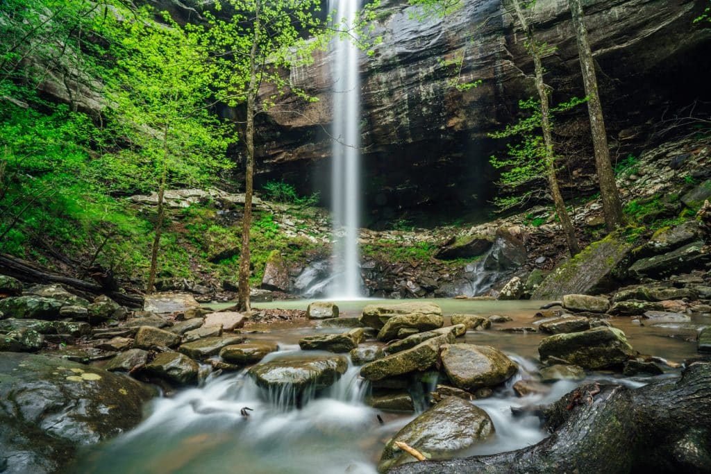
Triple Falls (aka Twin Falls)
Distance: .5 mile roundtrip
Difficulty: Easy
What we love about it: A great hike for nature lovers of all ages. The trail itself is only a .5 mile roundtrip hike that offers some grand scenery. With ample rainfall this double fall dawns a third waterfall.
Locals’ tip: The road down into Camp Orr is very steep in areas and can be fairly rough as well. We’d recommend an AWD vehicle for visiting this location.
Photography Suggestion: Bring something to cover and clean your camera gear! Triple Falls tend to create a lot of “spray” when flowing heavily and can soak cameras pretty quickly.
Trail Map:Download a free trail map to Triple Falls.

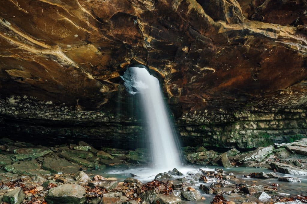
Glory Hole Falls
Distance: 2 miles roundtrip
Difficulty: Intermediate
What we love about it: It is one of the most unique waterfalls in Arkansas. Nature has created a hole in the roof of an overhanging bluff and the creek now flows through the hole to create a beautiful waterfall.
Locals’ tip: The area around the falls can be quite slippery and there are several high rock ledges. Please use caution and keep an eye on kids.
Photography Suggestion: Glory Hole Falls is located within the Dismal Creek Special Interest Area, an area protected for its unique botanical features. This makes the trail a great option for those wanting to photograph wildflowers in the Spring.
Trail Map:Download a free trail map to Glory Hole Falls here.
Sweden Creek Falls
Distance: 2 miles roundtrip
Difficulty: Easy
What we love about it: There are two trails contained within Sweden Creek Natural Area. One trail takes you to the top of the falls, and the other takes you to the bottom. Either route is extremely scenic and exploring both trails is highly recommended.
Locals’ tip: Looking for an easier stroll with a big payoff then take the top route, but if you are wanting a boulder-hopping adventure then head to the bottom of the falls.
Photography Suggestion: Cloudy days after big rains are the best time to photograph the falls. The upper route to the falls at Sweden Creek also offers incredible wildflower displays in the spring and early summer.
Trail Map: Download a free trail map to Sweden Creek Falls.
While visiting these special areas, please remember to leave no trace. Learn about Leave No Trace principles for protecting and preserving outdoor spaces so you can be a responsible hiker and camper at lnt.org.